


Pretty quiet around here...at least for the overnight. Mostly fair skies as morning lows fall to either side of 30 degrees by 7 a.m.

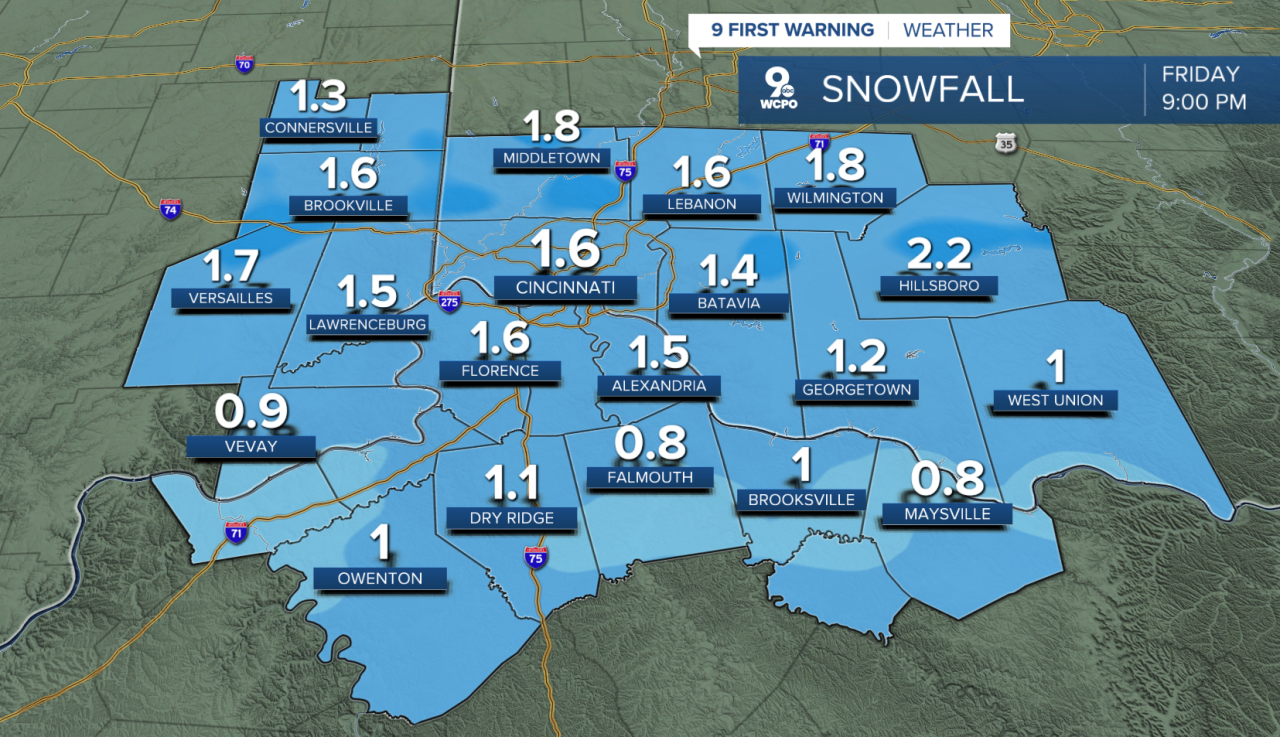
An area of low pressure that will pass to the south of us and it will first bring some early rain before changing to snow. Temperatures will only be around 40 as this starts, so it's going to be a wet snow. Plus, the pavement will be warm and a lot of the falling snow will initially melt. Light to, at times, moderate snow will fall through 9 p.m. across the Tri-State. The afternoon commute home will by slow and likely messy. Here's a look at the snowtotals:
Saturday will be much colder! We'll start the day at 23 and only warm to 32 degrees. A breezy northwest wind will make it feel colder throughout the day. Sunday will be sunny and a bit milder as highs return to the low 40s.

And before you know it, we are right back into the mid to upper 50s next week!
OVERNIGHT
Mostly clear
Colder
Low: 29
FRIDAY
Mostly cloudy, colder
Wintry mix turns to light afternoon snow
High: 40
FRIDAY NIGHT
Light snow early
Turning colder
Low: 23
9 First Warning Weather 24/7 Livestream
==========
- Interactive Radar: Track weather to your doorstep
- Sign up for severe weather email alerts
- Check latest school closings and delays
- WCPO traffic updates
- Metro bus detours and updates (or call the hotline at 513-632-7538)
- Latest power outages from Duke Energy
- Flight cancellations and delays from CVG, other U.S. airports
