


We officially have a heat wave! As of this afternoon, we have hit 90 degrees or higher for 3 days in a row. And the reality is, we have 4 more days to go.
New this afternoon, the National Weather Service has issued a HEAT ADVISORY. This will be for Tuesday and Wednesday afternoon. Heat indices are expected to range from 100-104 each afternoon.

When it comes to heat, you really should approach it as something to treat before it gets here. We should be drinking more water now to hydrate our bodies.
But also when it is the hottest, you should limit how much time you are spending outside and don't overexert yourself.
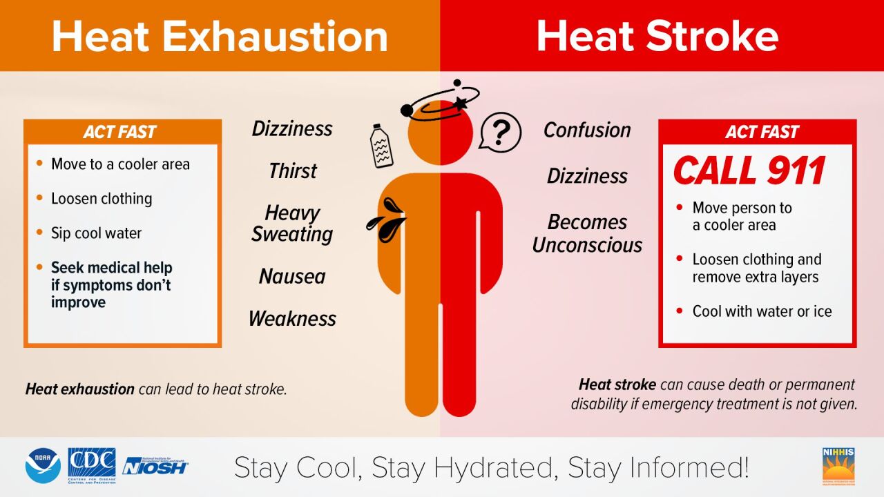
Here's a reminder to what symptoms to look for when it comes to heat exhaustion and heat stroke:
There are a few rain chances coming in this week but they aren't for everyone nor is it bringing a likely round of showers and storms.
We'll see a spotty rain chance north of the Ohio River on Wednesday from 5 to 10 p.m.
We'll see another rain chance Friday as a cold front moves through the Tri-State. This will bring a spotty storm chance. But most importantly, it will break the stretch of 90 degree days!
MONDAY NIGHT
Isolated chance
Partly cloudy
Low 71
TUESDAY
Mostly sunny
Heat advisory begins
High: 97
TUESDAY NIGHT
Mostly clear
Muggy
Low: 71
9 First Warning Weather 24/7 Livestream
==========
- Interactive Radar: Track weather to your doorstep
- Sign up for severe weather email alerts
- Check latest school closings and delays
- WCPO traffic updates
- Metro bus detours and updates (or call the hotline at 513-632-7538)
- Latest power outages from Duke Energy
- Flight cancellations and delays from CVG, other U.S. airports
