


CINCINNATI — The Ohio River crested Monday at the highest level it has been at in nearly a decade.
The river hit a peak of 60.79 feet Monday afternoon after multiple days of rainfall caused flooding in the Tri-State area.
That level put the region in a moderate flood stage — a level we've only seen once in the last 28 years. That one occasion was in 2018, when many of the communities hardest hit by recent flooding were also under water.
If you can, consider donating to help those who are affected by these most recent major floods here.
The worst flooding the region has seen in recent history was the flood of 1997. In that flood, the Ohio river crested at 64.48 feet after the region saw historic rainfall in a short period of time.
Here's a look back at how this flood compares to the region's most recent floods:
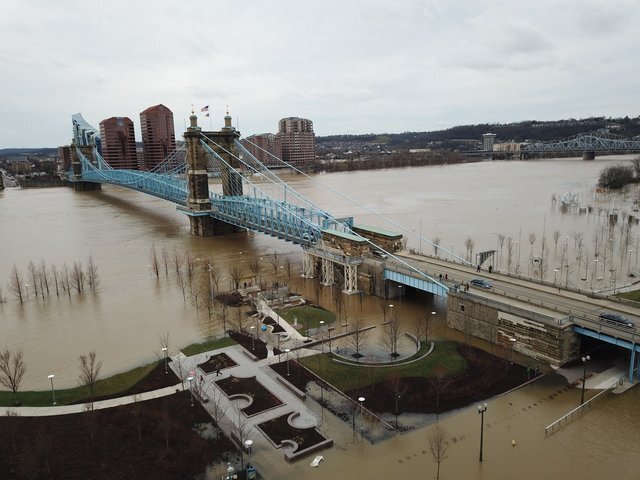
Cincinnati riverfront from Monday:

Here's how it looked during the 2018 floods, when the river hit 60 feet:
And here's how it looked during the flood of 1997, during which the flooding was much worse than it is today. During those floods, the Ohio River hit 64 feet at its crest. Note: this image is from the Kentucky side, while the two above are from the Ohio side of the river.

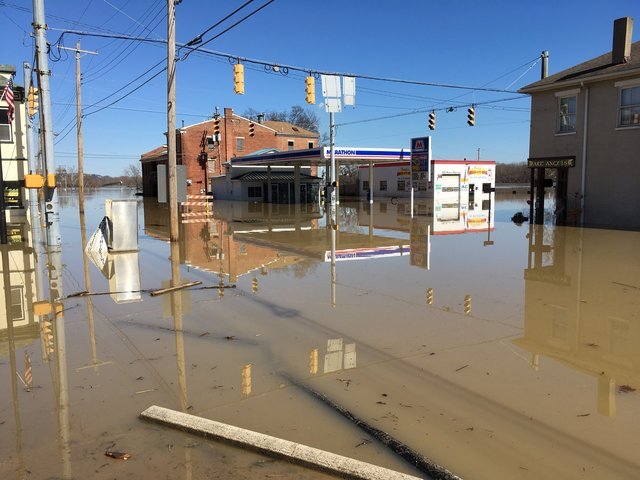
Flooding in Aurora, Indiana, on Monday:

Flooding in Aurora, Indiana in February 2018:
A look at downtown Aurora from Chopper 9 during the 1997 floods:

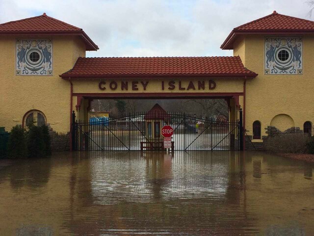
Flooding near the former Coney Island site on Monday:

Coney Island during the 2018 floods:
Next door, here's how Riverbend fared during the floods of 1997:

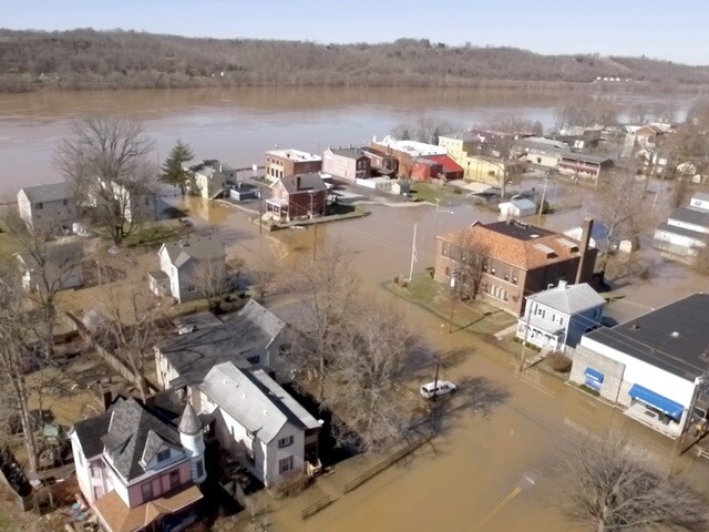
A look at New Richmond in Clermont County on Monday:

New Richmond during the 2018 flood:
Flooding in New Richmond in 1997:

Below is the breakdown from the National Weather Service and NOAA of what floods as the waters rise on the Ohio River.
- 60 feet — Significant flooding in East End, California and New Richmond in Ohio, with backwater floods in Silver Grove, KY, and riverfront buildings in Aurora Indiana. Stretches of U.S. 52 are flooded, with numerous additional low lying roads near the river flooded. Backwater flooding along the Little Miami, Great Miami and Licking Rivers, also result in road closures. Some main level of homes flooded in the East End sections of Cincinnati.
- 59 feet — Some of Route 52 is flooded from Cincinnati to New Richmond. Some homes incur flooding in California, Ohio, with several roads, Coney Island, and PNC Pavilion flooded. Backwater flooding in Anderson Township, and Fourmile creek in Silver Grove, flooding some homes along the creek. Low roads in the East End are also flooded. Portions of Route 8 in northern Kentucky become flooded, as well as portions of Aurora, Indiana. Basement flooding of low lying homes and businesses is widespread.
- 58 feet — Numerous homes and businesses are either surrounded by water, water in basements or on main levels. Backwater flooding along the Little Miami in Ohio and Fourmile Creek in Kentucky floods low lying streets and properties. East End, California and New Richmond in Ohio, along with Bromley, Ludlow, Silver Grove in Kentucky and Aurora Indiana are most impacted. Homes in New Richmond from Market Street to the river flood. Freeman Avenue near Mehring Way floods, as well as Gest and Elm on Pete Rose Way.
- 57 feet — Flooding surrounds homes between Route 52 and the river in East End, California and areas of Anderson Township. Backwater flooding along the Little Miami and 9 Mile Creek surrounds low lying homes and businesses in Pierce Township. Water also surrounds some on homes in New Richmond. Ludlow and Bromley in Kentucky become flooded in low areas, as well as Aurora Indiana along Judiciary and Water Streets. Portions of Route 52 in Ohio, Route 56 in Indiana, and Route 8 in Kentucky are flooded.
- 56 feet — A few homes along Debolt Road in Anderson Township are cut off, with a dozen homes incurring basement flooding. In addition to the significant flooding of Coney Island and Riverbend, a few businesses have been flooded along Kellogg Avenue. Widespread backwater flooding occurs, with Route 8 in Kentucky, Route 56 in Indiana and both Route 52 and old Route 52 flooded in areas. Locations most affected include low-lying areas near New Richmond, the East End, California and Anderson and Pierce Townships.
- 55.5 feet — Low-lying roads near the river flood in Anderson Township and East End near Kellogg Avenue, with stretches of Kellogg Avenue flooded. Basement flooding occurs in the East End. Flooding occurs along sections of Route 52 in Hamilton and Clermont Counties. Low-lying roads in Bromley and Ludlow also flood stretches of Route 8 in Kentucky and State Route 56 near Aurora, Indiana.
- 55 feet — Low-lying roads near the river continue to flood, with much of Anderson Township, the East End and California affected along Kellogg Avenue, with stretches of Kellogg Avenue closed. Much of Riverfront Live in East End is flooded. Backwater flooding affects many locations near the Ohio River. Flooding affects sections of Route 52 in southeast Hamilton and Clermont Counties. Backwater up Twelvemile Creek begins to flood low areas of northwest New Richmond. Low-lying roads in Bromley and Ludlow also flood.
- 54 feet — Backwater flooding up the lower Little Miami River as far upstream as Newtown occurs, worsening flooding in California and Anderson Township. Low-lying areas near New Richmond in Clermont County also flood. Flooding also worsens in the East End. Flooding occurs near Petersburg, Kentucky, along Belleview Road near the Woolper Creek Bridge, as well as near State Route 56 and Water Street near Aurora, Indiana. The Sawyer Point Amphitheater area and Riverside Drive in Covington are flooded.
- 53 feet — The access road at Covington Landing becomes flooded. Flooding begins on Riverside Drive in Covington. Flooding in California worsens in Anderson Township. New Richmond in Clermont County also experiences flooding and worsening flooding in the East End. Backwater flooding up Laughery Creek between Dearborn and Ohio Counties in Indiana causes flooding along Nelson Road and Cole Lane. Lower levels of Smale Park and Bellevue Beach Park are flooded.
- 52 feet — Increasing sections of Kellogg Avenue from east of Delta Avenue upstream to near Coney Island to near Eight Mile Road are flooded, as well as parts of Humbert Avenue in the East End of Cincinnati. Most of Public Landing is flooded, as well as Riverside Park off River Road.
