

COVINGTON, Ky. — An updated Licking River forecast shows it will crest just below a "major" flood stage and some residents were asked to leave.
The Licking River reached a flood stage just below "major" flooding, cresting at 38.5 feet Sunday night.
The City of Covington encouraged residents in a particular area to leave due to the rising floodwaters. If you live in the area of Virginia Avenue and 45th Street, the city says you should leave and go to Latonia Elementary School, where the Red Cross has set up a shelter.
This is near the intersection of the Banklick Creek and the Licking River.
For those wishing to seek shelter, you can head to the rear entrance of the school.
We spoke to Roger Mcelfresh, who grew up in the area, and said he learned from a previous major flood.
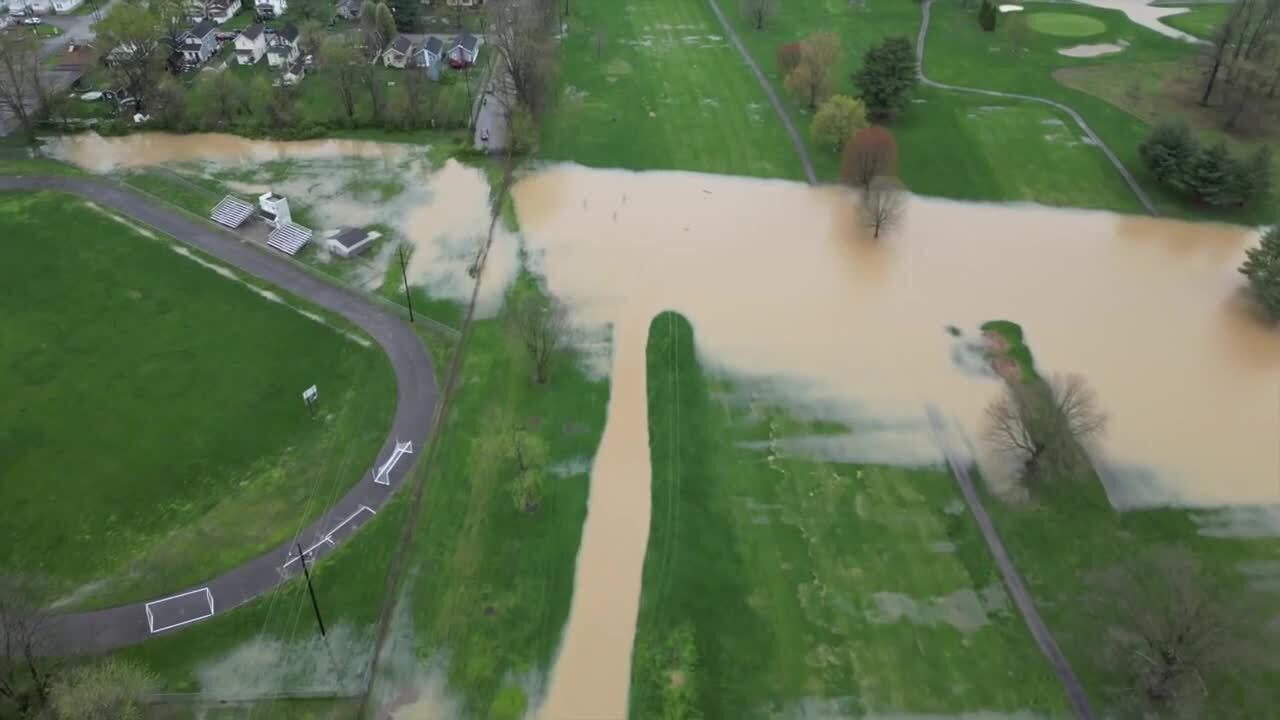
"Because I remember in 97, the way that it was I mean the water did get all the way up to our porch and I won't stick around for that scene," Mcelfresh said. "Just seeing everything, people's houses, flowing all the way on the golf course over here, I wouldn't want to be stuck in that."
See the impact of Ohio River and Licking River flooding in Covington in the video below:
Further down the river, residents in Falmouth and Butler are under mandatory evacuation orders.
Scroll down to the bottom of this story to see the impacts of flooding at each foot level along the Licking River.
You can explore more about where the Licking River is expected to spill over with NOAA's interactive tool here. Drag the slider left or right to see the normal river boundaries and the forecast spillover.
Here is a look at what's affected by flooding at each foot level of water (Information from NOAA):
- 38 - Main Street begins to flood near the river, and flooding along Shelby Street and State Route 22 east of Falmouth worsens. Flooding also begins along Riggs Street.
- 37 - Shelby Street begins to flood, and flooding of low-lying streets near the river in Falmouth worsens. Flooding is worst along State Route 22 east of Falmouth.
- 36 - Street flooding occurs in the Shoemakertown area east of Falmouth, and in low areas of Butler. Flooding begins along Montjoy and Second Streets in Falmouth.
- 34 - Parts of State Route 22 east of the Falmouth business area begins to flood, as well as along Route 22 northeast of downtown in Shoemakertown, on the east side of the river.
- 33 - Basement flooding begins along Water Street in Falmouth, and flooding beginning along a low area of Route 22 east out of Falmouth. Lowland flooding can be expected in both Butler and Falmouth.
